Championing Restoration: Hero Spotlight, Joshua Rey
Follow ( 0 Followers ) X Follow E-mail : * Follow Unfollow
It took only a summer of excavating to shape and enhance new mudflat habitat. Back in June, we shared that earth-moving activities were beginning just west of I-5. In that post, we explained how crews were beginning to build mudflats. What is a mudflat? Mudflats are muddy areas that are submerged and exposed every day as the ocean tide rises and falls.
Fast forward to August and the mudflats in this area are complete. View our series of photos that show the evolution of this project, below:
![]()
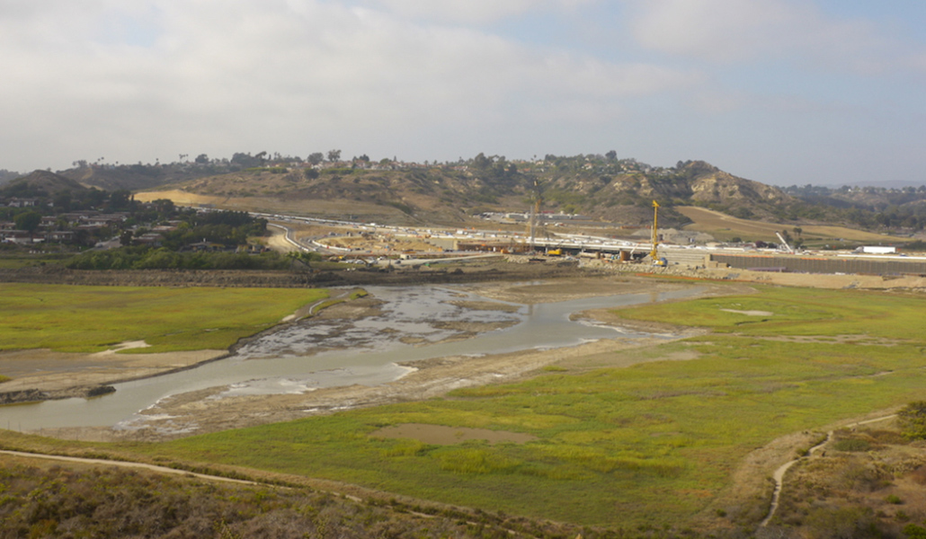
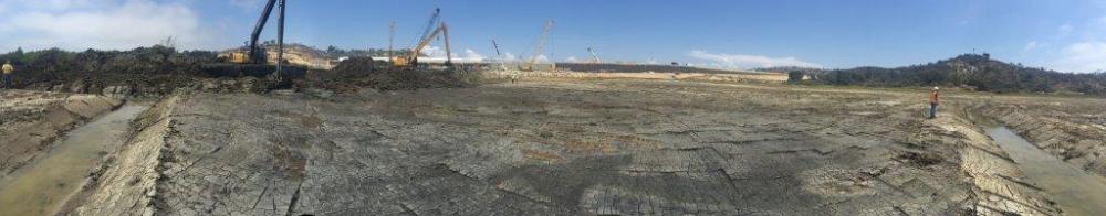
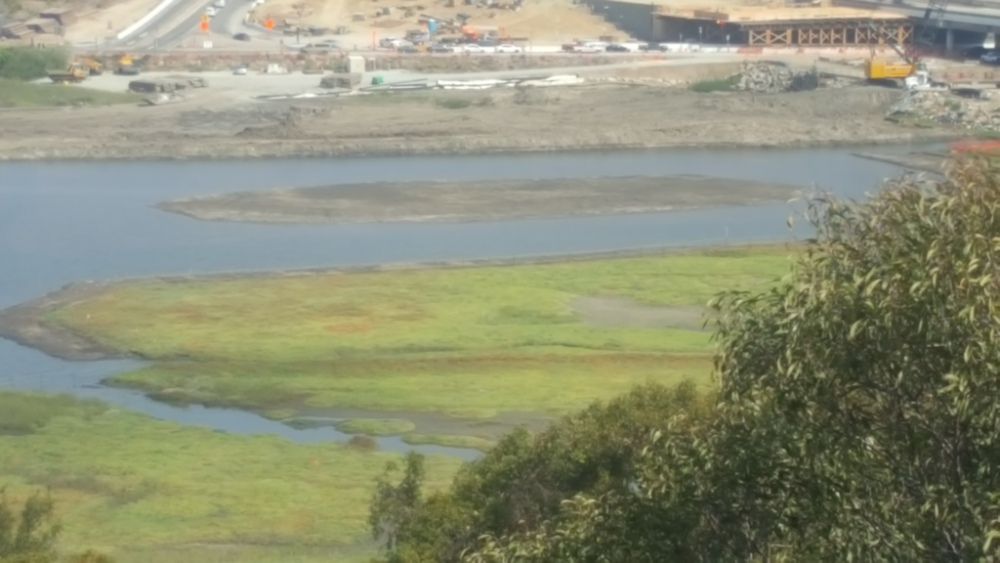
Above: The existing mudflat elevation and the new mudflat elevation
The elevation of the existing mudflat is at the same elevation as the existing vegetation, which means the amount of saltwater that floods this area is optimal to the growth of salt marsh plants. The different habitat elevations in an estuary are determined by the duration of saltwater on the habitat. For intertidal mudflats to exist, the area has to be inundated with salt water for a longer duration than the areas that support vegetation. With this in mind, the new mudflats were designed and created at a lower elevation.
Historically, San Elijo Lagoon did not have low salt marsh vegetation and was mostly mudflat habitat. Over the past decade, most of the historic mudflats in the Central Basin of the lagoon converted to a vegetated, low salt marsh habitat of California cordgrass. As a result, this new habitat now supports the third largest population of endangered Ridgway’s Rails in California.
The conversion of these habitats has had both positive and negative impacts on the species of the lagoon. On one side, we are playing an important role in the recovery of the Ridgway Rail population. On the other, the loss of mudflat habitat has dramatically affected the abundance of shorebirds. One of our goals in Reviving Your Wetlands restoration is to create a balance of tidal habitats throughout the estuary.
We chose to create our new mudflat habitat in the southeastern area of the Central Basin because it had not yet converted to the lower salt marsh habitat and therefore would not impact Ridgway’s Rails.
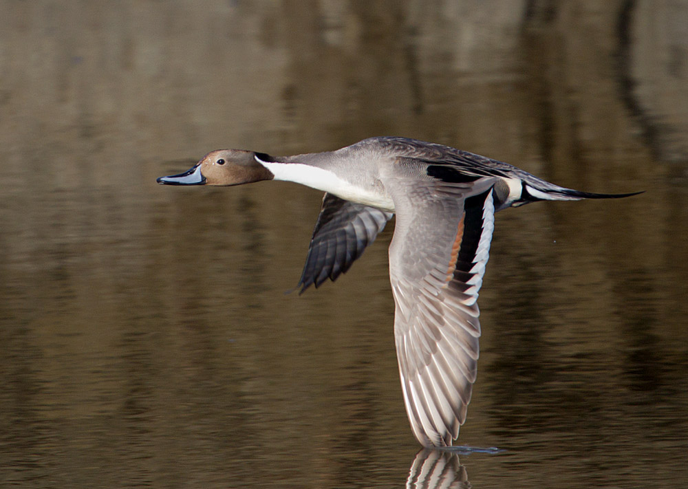
Above: Northern Pintails migrate amazing distances. They come here in the winter from their nesting areas in Canada or Alaska. This is a dabbling duck, meaning when feeding, they submerge their heads underwater with tails in the air. They’re looking to consume seeds, bulbs, aquatic insects, crustaceans, and snails in the tidal channel and mud. Photo by Chris Mayne
Animals take advantage of changing tides when feeding. At low tide, mudflats are exposed on the upper edges of the salt marsh. Within the salt marsh are tidal creeks and mudflats that are submerged and exposed twice a day as the tide rises and falls. See our post Birds Need Mudflats—We’re Here to Help.
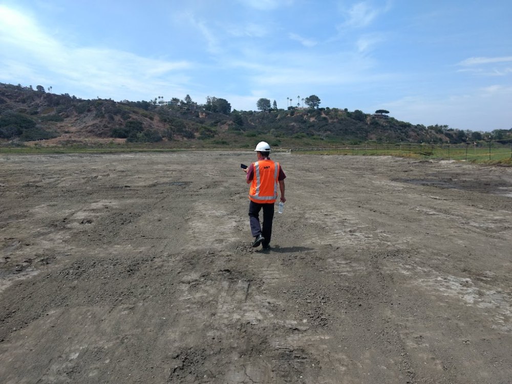
Above: A crewmember surveys the newly excavated and sculpted mudflat area. Work here had to be completed before the first tidal flushing occurred because sculpting the topography of this area to the precisely planned elevations required dry mud.
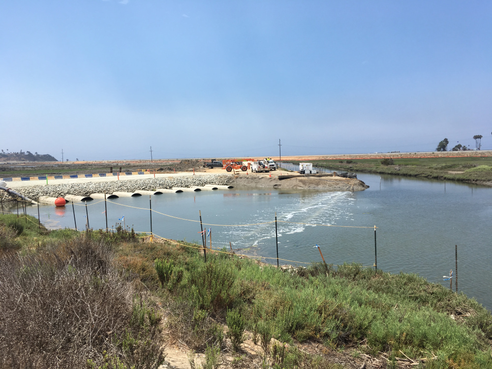
Above: This is the newly created mudflat and the pre-existing channel just moments before the first tidal flushing on July 28, 2018.
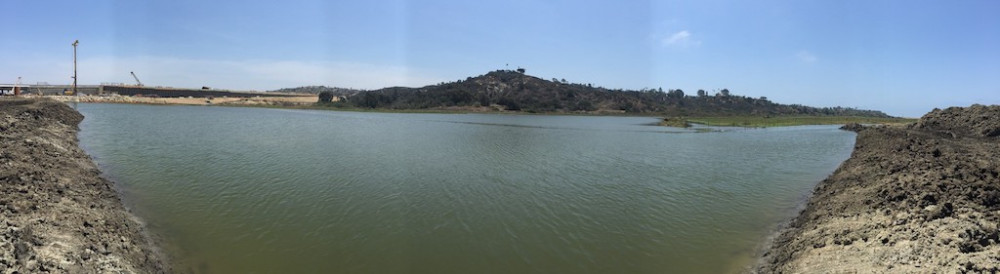
Above: The newly created mudflats are covered in salt water after the first tidal flushing (which was a 6-foot tide).
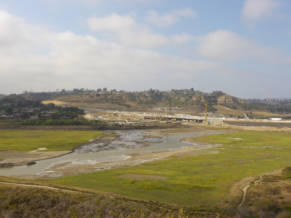
Above: A photo from a vantage point above the lagoon shows the first saltwater flows arriving in this area. See where the water is—and is not. The project is designed to have many elevations of mudflat habitat.
Above: Water continues to flood the area, as planned, during tidal flushing.
You might be wondering, why are all the mudflats now covered in salt water? Fluctuating tide levels are important for animal feeding schedules and for saltwater intake and release in plants. More importantly, by having different elevations, we are adjusting to sea level rise and extreme tides now, and in the coming decades.
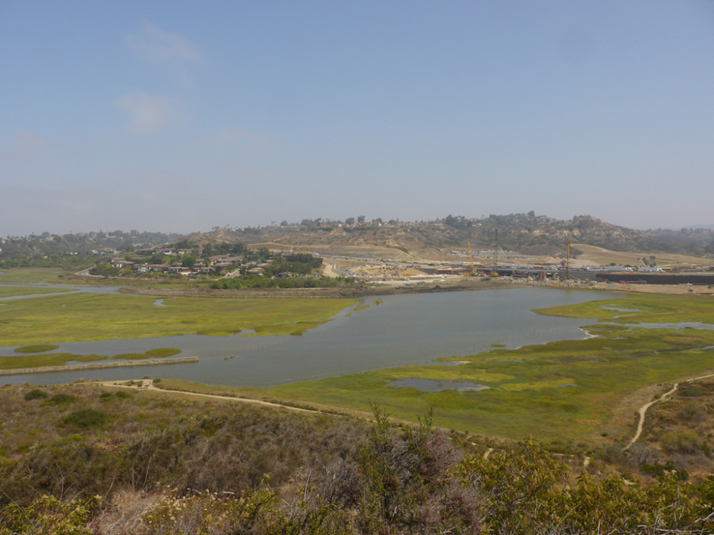
Above: As the water begins to recede, you start to see portions of the higher elevation mudflats popping out from the salt water. As the water continues to recede, you will see different elevations appear. This photo was taken at the top of Annie’s Canyon Trail. If you have polarized sunglasses from this vantage point, you can clearly see the pre-existing small channels beneath the higher water level.
The next tidal flushing begins today, Friday, August 10. There will be a 7-foot tide. Even though the first tidal flushing was just two weeks ago, our goal with this flushing is to allow salt water to flow a bit farther into the southeast side of the Central Basin and provide much-needed water to habitat that the last flushing did not reach. Neighbors can expect nighttime lighting during tidal flushes, nearest to the temporary dike, located in front of the nature center.
Above: Air bubbles are seen at the water surface.
Nature Center Loop Trail visitors may notice air bubbles at the water surface just north of the temporary dike and wonder what is causing this.
Yesterday, crews installed a fish diversion aerator system, or bubble curtain, beneath the channel. This bubble curtain is a best management practice that our project is adopting to keep fish from making their way through the dike and into the active work area where dissolved oxygen levels are low.
The bubble curtain is created when two pipes that are placed on the bottom of the channel push air through a series of holes. This creates a wall affect in the water that will keep most fish from entering the work area and instead make their way into the channel to the right. This is a new technology. We are one of the first projects to use this system for this purpose.
Reviving Your Wetlands restoration is all part of creating what for so many years—decades—has been a shared dream by many stakeholders in this project: the flow of healthier waters and an increase in wildlife diversity at San Elijo Lagoon. We can’t wait, as well, for new trail connections. It’s exciting to see the visual effects of long-range planning.
Thank you for following Lagoon Connections!
Follow ( 0 Followers ) X Follow E-mail : * Follow Unfollow
Follow ( 0 Followers ) X Follow E-mail : * Follow Unfollow