Championing Restoration: Hero Spotlight, Joshua Rey
Follow ( 0 Followers ) X Follow E-mail : * Follow Unfollow
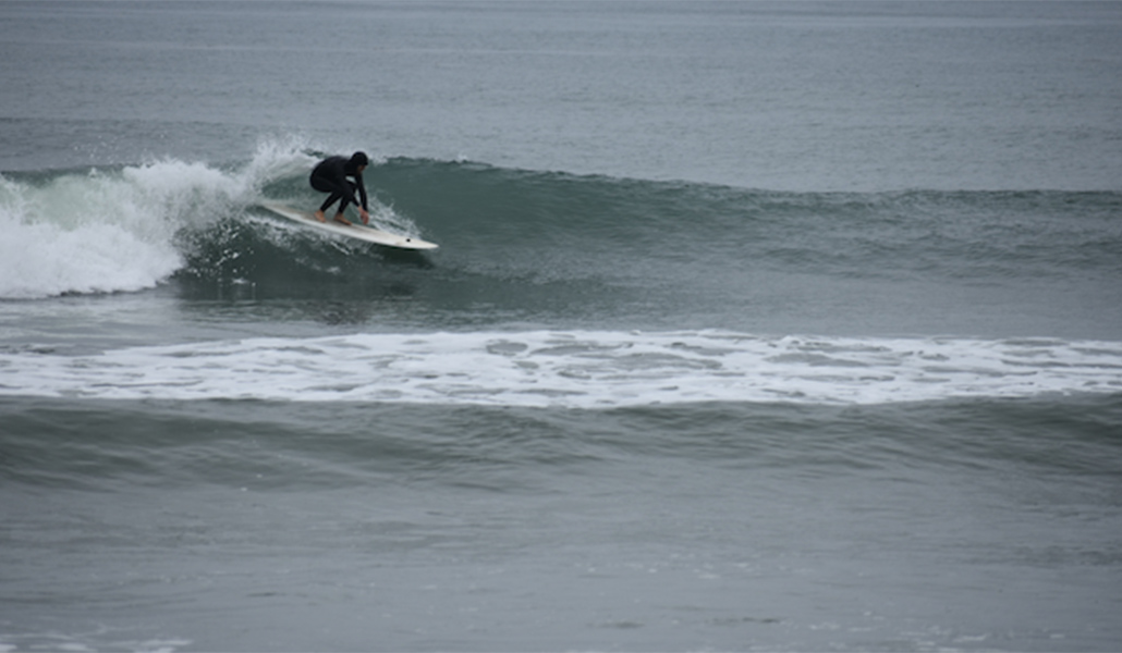
Conservancy Scientific Program Director Tim Stillinger heads out for a surf using one of three customized Christenson boards (the black dot is the GPS sensor) for the Reviving Your Wetlands Surf Monitoring study.
While many surfers are riding waves for pleasure and exercise, there’s one surfer in North County in the water to monitor wave conditions in Solana Beach and Encinitas.
Meet local surfer Tim Stillinger. He grew up surfing San Diego’s North County with his family and friends. Tim is the Conservancy’s Scientific Program Director, who rejoined our staff team last year to help with the magnitude of scientific monitoring in Reviving Your Wetlandslagoon restoration.
“This study is a big step forward from subjective surf reports, the existing standard for quantifying and visualizing how surfing resources respond to beach replenishment projects,” shared Tim Stillinger. “Along with fulfilling monitoring requirements for the San Elijo Lagoon Reviving Your Wetlands restoration, we are setting a precedent and guidelines for future coastal projects to follow best practices. The data also doubles as a great baseline for analyzing long-term trends in our surfing resources in the context of climate change and sea level rise.”
Tim is surfing with a GPS tracker up to four times a week, sometimes three times a day, between Cherry Hill, Fletcher Cove, Seaside Reef, George’s, Cardiff Reef, Pipes, Swami’s, and D Street. The goal is to gather location data on the waves at each of the study sites when conditions are good across a range of wave sizes and swell conditions.
Tim is carving out a new line in surf science. He is creating and will be collating, years of data on local surfing conditions and beach sand replenishment impacts, if any, that may be associated with lagoon restoration.
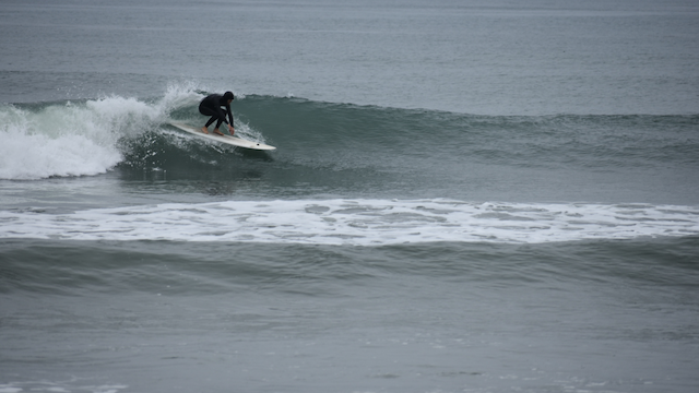
Tim deep in the pocket of a wave at Seaside Reef as his GPS monitors the wave’s location for the Reviving Your Wetlands Surf Monitoring Study.
Analyzing beach sand replenishment projects in comparison to surfing conditions is new in surfing science. Tim’s goal is to ride as many waves as possible in a short amount of time to gather data on the quality of waves in these seven study areas. Back at the office, he downloads the data and compares it to pre-restoration data he collected. Tim is looking to see if sand, moving through the surf zone from the restoration beach replenishment, is causing changes in the locations where you catch waves or the direction and distance you surf them.
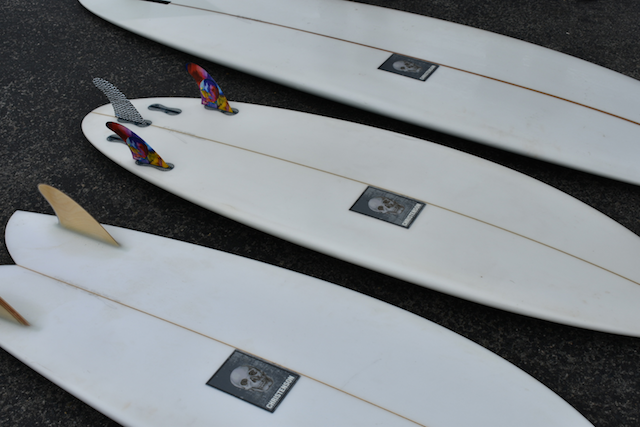
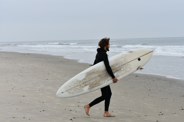
Three Chris Christenson custom surfboards were secured for the Conservancy’s Surf Monitoring Study that began last year. For different conditions, Tim rides midlength, shortboard and fish designs. This hyper-local surf monitoring study is being conducted by your local Conservancy, using locally sourced boards.
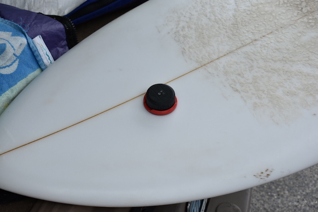
This is the GPS sensor providing precise data on the direction and speed of a wave. It takes an accurate position measurement 5 times a second, enabling calculation of location, speed, and acceleration, which is used to create maps of the surfing breaks.
Now, and in years to come, the data will be analyzed and mapped with supporting shoreline data. The Surf Monitoring Study is building the bigger picture of how beach sand replenishment benefits, has no effect or has some effect on our local surf breaks.
Tim has a BS in Molecular Environmental Biology from UC Berkeley, a Masters of Environmental Science and Management with a specialization in Water Resources Management from the Bren School at UC Santa Barbara, and is completing his PhD from the Bren School.
Thank you for following Lagoon Connections as we keep you up-to-date on the actions underway for healthier waters, habitats, and new trail connections.
Follow ( 0 Followers ) X Follow E-mail : * Follow Unfollow
Follow ( 0 Followers ) X Follow E-mail : * Follow Unfollow